Thursday, July 3, 2014

ENGLAND AND IRELAND 2014


We started this trip attending a wedding and visiting family and friends in England, Northern Ireland and the Republic of Ireland.   We flew out from Comox to Vancouver and then to London Gatwick.  We collected a car and our first night was in Ripley in Surrey which was convenient to Windsor where we were going the next day to be at Martin Berwick's wedding to Trudie.  The wedding was held a Oakley Court a very splendid hotel on the banks of the River Thames.  This was a good chance to catch up with the Berwick family who were present in force apart from Peter and Pik Yee who were unable to make it across the ocean from New York.

The wedding and reception went off very well and a good time was had by all. 


Making it legal

Megan, Dan, Osian and Thomas

Megan the flower girl
The next day we took off for Balsall Common where we spent part of the afternoon with Valerie, Ella and Toby before moving on to Stourport where we stayed one night at a local B and B and were able to spend time with Don and Jean. Next stop was a couple of nights with Anthony and Carol in Derby.  Making our way North we stopped in at Bradbourne where by chance Hilary Strudwick was spending a week with some of her family in a lovely cottage.  Continuing on we spent one night in Glossop near Manchester where we met up with Barbara and Derry Webb who were moving to that area from Abingdon. 


This move had been a long drawn out process that began before Christmas but for many and sundry reasons had all been held up and whereas we were going to stay in their new home all we managed to do was see it from the outside but at least we know where they will be in the future.  They moved in a few days after our visit.  

Derry and Barbara in Marple
 On to Manchester Airport and a flight to Belfast were we were met by Paddy and John Wallace who were our near neighbours in Dunmurry many years earlier.  They live in an older house in Randalstown with a really beautiful and large garden. We spent the night with them and the next day met up with John and Jane Logan who came in from Ballymena. We had lunch with them in Antrim before we caught the train to Belfast where we were spending one night. 


Robin, John Wallace, Jane Logan, Ruth and Paddy       John Logan took the photo


We had arranged to set up two meetings with old Belfast friends, the Halls and the Robinsons on the afternoon and the Duncans, the Blairs and Rosemary Simpson in the evening.  This turned out to be an efficient way to meet a number of folk without needing to travel around at all, a blessing because we are now on public transport only.  Next day took us to Dublin on the Enterprise and we stayed the one night with Bennie and Kay Neill, who we had first met in Dunmurry all those years ago.  Bennie retired relatively recently and had moved into a very pleasant house with attractive garden in Killiney close to Bono, Eddie Irvine and Enya!. 

The Enterprise to Dublin


That saw the end of friend and relative visiting and we were ready for our time in the West of Ireland.


WALKING THE WESTERN WAY

DAY 1 and DAY 2 - GALWAY CITY TO INISHMORE

We went on a self guided walking holiday in County Galway and County Mayo.  The holiday was arranged through Hillwalk Tours based in Dublin, Ireland.  They arrange the overnight accommodation, necessary transportation and most importantly arrange for the main luggage to be transferred ahead to the next accommodation address.  This means that during the day all you need to carry is a small backpack with necessary items like some food and wet weather gear, remember we were in Western Ireland. 

We took the train to Galway on the West coast.   Before catching the train we had arranged to leave one suitcase near the station so we had less to travel with on the walk and so we were left with just two small backpacks and one large backpack.  The last time we had used the train in Ireland was in 1960 when we went to the same West coast after Anthony and Carol's wedding.  We were retracing some old steps.  The trains have changed markedly as instead of good old fashioned steam were on a nearly new diesel train (made by Hyundai).  Our walk took us to one of the Aran Islands and then onto the mainland where we started out on the long distance path, the Western Way.

You can see a larger version of any photograph by simply clicking the mouse once on the image. Another click outside the image returns you to the text  

Dublin to Galway

Arriving in Galway we collected ferry tickets to get us to the largest of the Aran Islands, Inishmore where we were to stay two nights and walk on two separate parts of the island.  Hillwalk had made excellent arrangements for us and we took the bus from Galway Town out to the ferry terminal at Rossaveel.


The ferry ride took about an hour and our instructions suggested we phone the B and B ahead of our arrival so that they could collect us.  We had bought a cheap cell phone for use in Ireland and made the call from the ferry.  It turned out the lady owner was on the same ferry! and we made contact then and there.  Her husband was going to meet her at the ferry terminal so we were all set up.

Inishmore ferry
The B and B was not a great distance from the terminal but we appreciated the ride anyway.  The B and B was excellent and we were made very welcome and looked after well.  The room was large by Irish B and B standards, en suite, as they all were.  We had great full breakfasts and they couldn't have done more to make our stay enjoyable.


Ti Catherine B and B
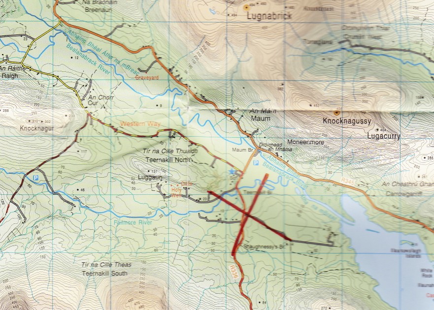
On our first walking day we went to the Western end of Inishmore.  We had been provided with detailed walking instructions and a complete set of maps for the entire time.  This made finding our way quite easy and we never got lost.


Inishmore

The large red cross marks the location of the B and B.  Our walk took us around the North coast, you will need to click on the map to show enough detail.  We reached the little settlement of Cill Mhuirbhigh (Kilmurvey) where we took a lunch break at Nan Phaddy's cafe.

Along the North Shore

Nan Phaddy's cafe

The principal attraction in this area is the Dun Aengus Fort.  This impressive 3,000 years old fort sits 100 m above the Atlantic Ocean and its massive walls run right up to the cliff edge.  No fences guard the sheer drop.  The fort is protected by three concentric walls.  This was one place where we met many other tourists otherwise we were nearly always alone on our walk.


Dun Aengus Fort

The coast at Dun Aengus
Along the path between the stone walls

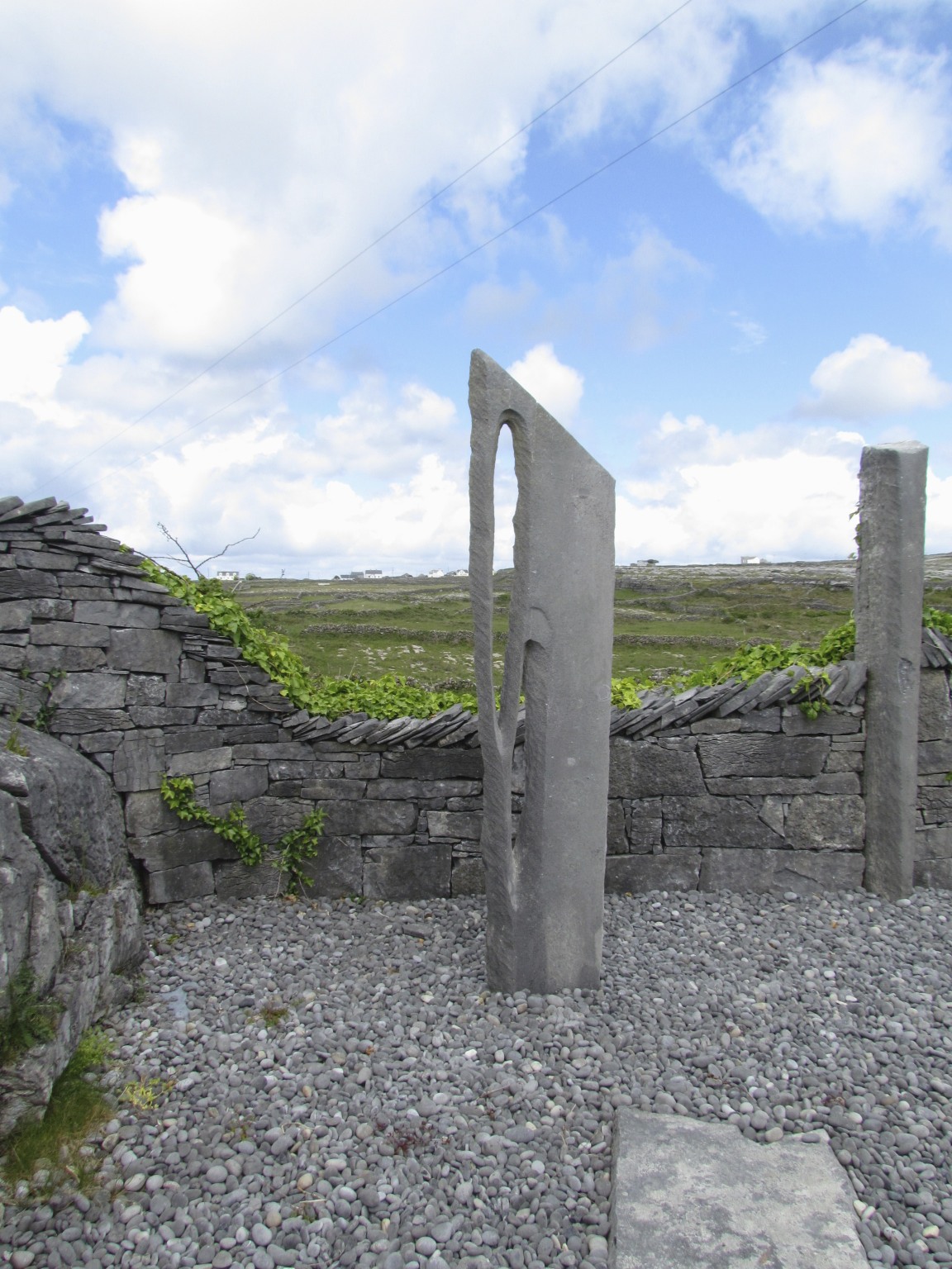
We came across a sculpture garden that was dedicated to Liam O'Flaithearta (1896 - 1984) who was born in the remote village of Gort na gCapall through which we had just passed. Liam was a significant Irish novelist and short story writer and a major figure in the Irish literary renaissance.

The Scuplture Garden at Gort na gCapall


Detail of one of the sculptures in the garden

The walls use large amount of loose rock and stone which are readily available.


The whole region back was basically large flat slabs of rock and this is the same rock formation that you find on the Burren on the mainland as the Aran Islands are just a continuation of that region.


The Aran Islands are a popular area for the tourist. Each day a whole hoard of folk arrive on the morning ferry from Rossaveal and spend the day on the island returning later in the afternoon.  Most get out to Dun Aengus and many use a pony and trap to cover the eight or so kilometres which we had walked.  

The lazy man's way to get around Inishmore


All together on our first day out we covered about 17 kilometres, which was going to be one the longest distances we covered in a day.  A good start to the adventure.

The weather was wonderful, only one rain shower that we managed to miss, just.  We felt ourselves lucky as it rains two days out of three in that part of the world. 


DAY 3 - ON INISHMORE

We spent a second day walking on Inishmore and this took us to the Eastern end of the island.

You can see a larger version of any photograph by simply clicking the mouse once on the image. Another click outside the image returns you to the text   

We left the B and B and walked South and onto a track that took us out to the coast to the Black Fort - Doonaghard on the map.

The coast the Black Fort


The Black Fort sits at the edge of the sheer cliff and the walls form part of a circle. It is believed that it was originally a full circle built on a promontory that has been slowly erode by the sea leaving just part of the circle at the cliff edge, like Dun Aengus. The walls are extremely thick as you can see, up to 6 m high and 5 m wide.


The "To prove we were both there" photo

The Black Fort exterior

On our way back from the Fort we passed close by a number of herons on their nests.


We saw some potatoes growing in what looked like rather poor soil which has been generated from sand and seaweed over many years.  There was plenty of room for rain water to collect between the rows


 Our next port of call was a tiny early Christian oratory high upon a hill.


This is the church of St. Benan which claims to be the smallest church in the world.

It certainly was very small
The view over Inishmore


The view out of the tiny entry


On our way down from the church we passed by the Round Tower. This 9th Century tower was once 35 m high and was part of the monastic village of St. Enda.
The Round Tower

 We retraced our steps to the B and B, collected our baggage and made our way to the ferry terminal to catch the evening ferry back to Rossaveal. 

The Bar where we had one of our evening meals . Two horse and buggys wait for customers

At Rossaveel we met by a rather worse for wear taxi that took us successfully to Oughterard on a lovely cross country road where we were staying the night.

The Oughterard B and B - the Woodlands


DAY 4 - OUGHTERARD TO MAAM

Our first day on the mainland took us along the side of Lough Corrib, a favourite fishing spot.  Lough Corrib is the largest lake in  the Republic of Ireland and covers 176 sq km.  It is reputed to have 365 islands but is more likely to have 1200.  The first canal in Ireland was cut from Lough Corrib to the sea at Galway.

You can see a larger version of any photograph by simply clicking the mouse once on the image. Another click outside the image returns you to the text  

The start of the day
The end of day


Our walk had been classified as Gentle.  The other options were Moderate and Challenging.  Gentle meant we did less walking per day and were sometimes helped along the way.  Today was such a day and we were taken by taxi along the road beside Lough Corrib to the right hand red circle marked on the upper map.  In actual fact the driver made a slight mistake and took just a little further than that, at the Parking Spot on the map which cut just over 2 km off the potential walk that day.  We didn't complain.  While we were taking our taxi ride another car was taking the larger back pack to the next B and B in Maam.  The Western Way actually starts in Oughterard and the Challenging hikers start there adding quite a bit to the day's walk.

We set off down a forest track along the lake side.

The start of our days on the Western Way which was very well signposted the whole way

Beautiful Lough Corrib
A Fuschia hedge along the way

Initially we were on a lane, then a rough track and then, as we entered a forest, we were on a sturdy board walk.  This board walk took us across boggy land and was 5 kilometers in length.

The studded boardwalk across boggy land

We found a seat along the way and had a spot of lunch.  As were taking a break another walker came by, a rare event as we said earlier.  This wiry fellow was from Alberta and he was carrying everything on his back and was camping along the route.  He took off at a speed rather greater than we were achieving and, we found out later, covered exactly twice the distance we were covering that day as he stayed at the same B and B where we would arrive the next day.  We had news of him on other occasions as well.

The view at our lunch stop

We reached the end of the board walk and made our way out of the forest and onto the road marked with the left hand red circle on the upper map.  Our route notes had suggested we phone the B and B as we left Oughterard to give the owner a rough time of arrival at the road so that she could drive down from the B and B to take us the remaining distance  - a "gentle" benefit.  The notes also suggested we could order a meal for the evening as there was no other place to eat at the destination. Because we had been dropped of further down the road at the start than the route notes indicated and because we arrived at the road early and we decided to walk the final section along the road adding about 4 kilometres to the day's walking.  As a result of all this we arrived at the time we were due to be picked up so it all worked out well.  A nice cup of tea and a biscuit awaited us at the B and B which was also a working farm, plenty of sheep around to prove it.

We enjoyed a full meal in the company of two other people, a girl from Austria and an older lady from the USA who were on a horse riding vacation.
DAY 5 - MAAM TO LOUGH INAGH


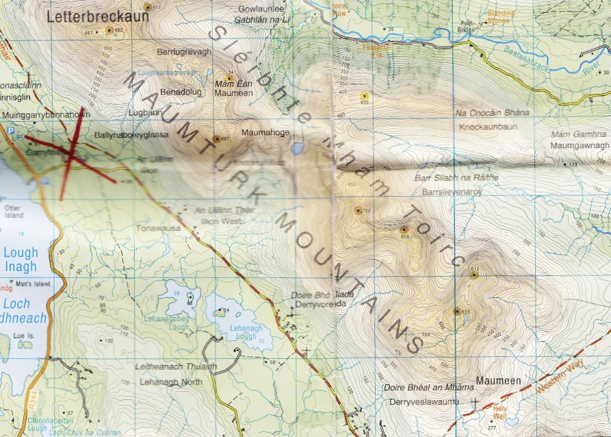
To that point the weather had been really nice and dry, except for a short shower on Inishmore, warm and sunny.  Today it all changed and we faced a more difficult section of the walk with the promise of rain and wind, we got both.

You can see a larger version of any photograph by simply clicking the mouse once on the image. Another click outside the image returns you to the text  

The start of the day at Maam

The end of the day at Lough Inagh


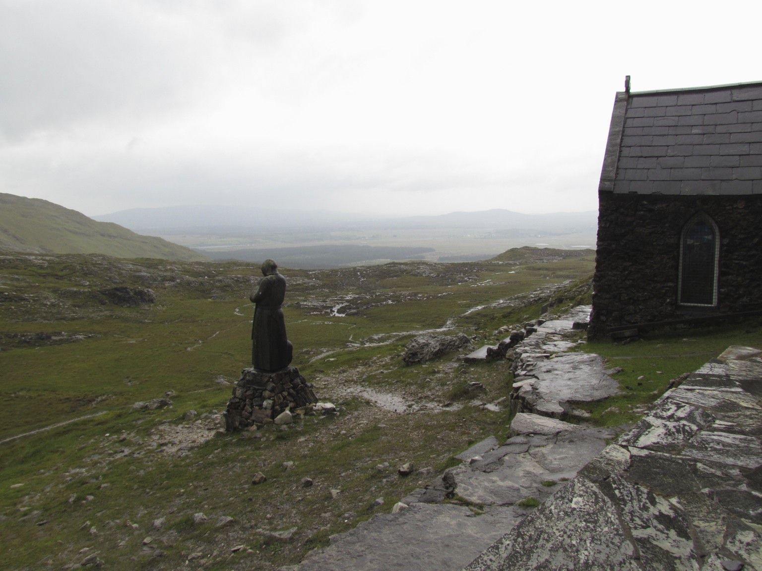
The first 4 kilometres were along a metalled road, with almost no traffic , which changed to a rough track.  We were now in somewhat more challenging terrain, first a climb up and over down to a river and then a long drawn out climb to a pass up a very rough track.  It was raining for much of the climb and we had a strong wind behind our backs but fortunately we had good rain gear   It would have been no fun going the other way.  At the top of the pass in the Maamturk Mountains we came to a small chapel at Maumeen (The Pass of the Birds)This was a pilgrimage spot where Mass is held three times a year.  Beside the chapel was a small stone altar and scattered around the rocky boggy site were the twelve stations of the Cross.

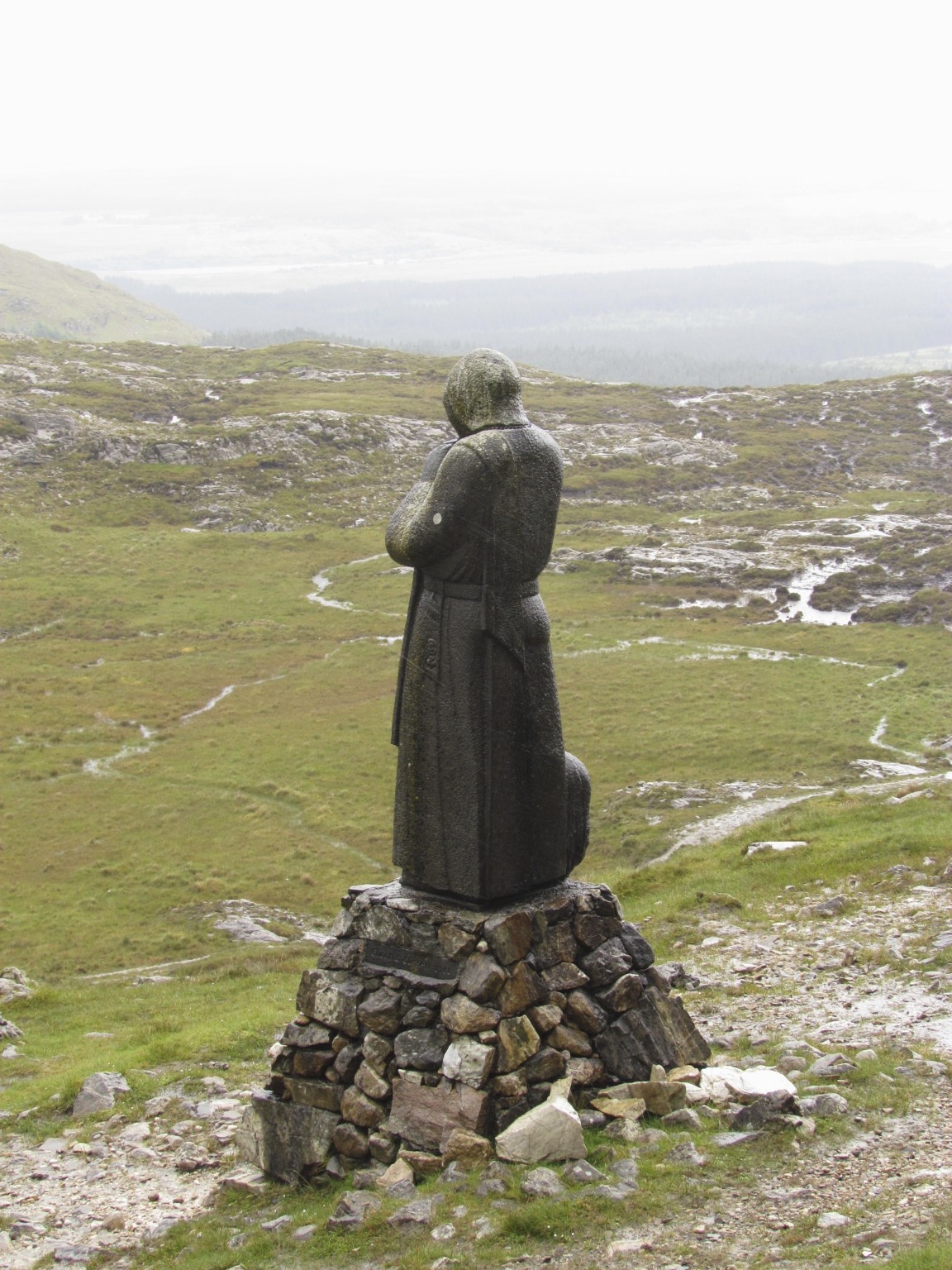
The small chapel and the statue of St. Patrick


The statue by Cliodna Cussen, dated 1986, depicts Patrick with a ram. The inscription in Irish on the base reads "Pádraig Mór na hÉireann, Aoire Máméan" (meaning "Patrick-the-Great of Ireland: Shepherd of Maumeen".) 


The Mass Altar on a wet and windy day
The altar served as our dining table.  The typical Irish breakfast consists of lovely meaty bacon, a fried egg or two, two sausages, mushrooms, black and white pudding and, on Aran, baked beans.  We soon realised that this was more than a hearty meal so we always put the sausages into the back pack and these were the basis of lunch each day.

The chapel at Maumeen
We left the lunch spot and climbed down an even rougher track which, because of the rain, was more of a stream than a track.  We met two unfortunates going the other way battling the gusty wind.
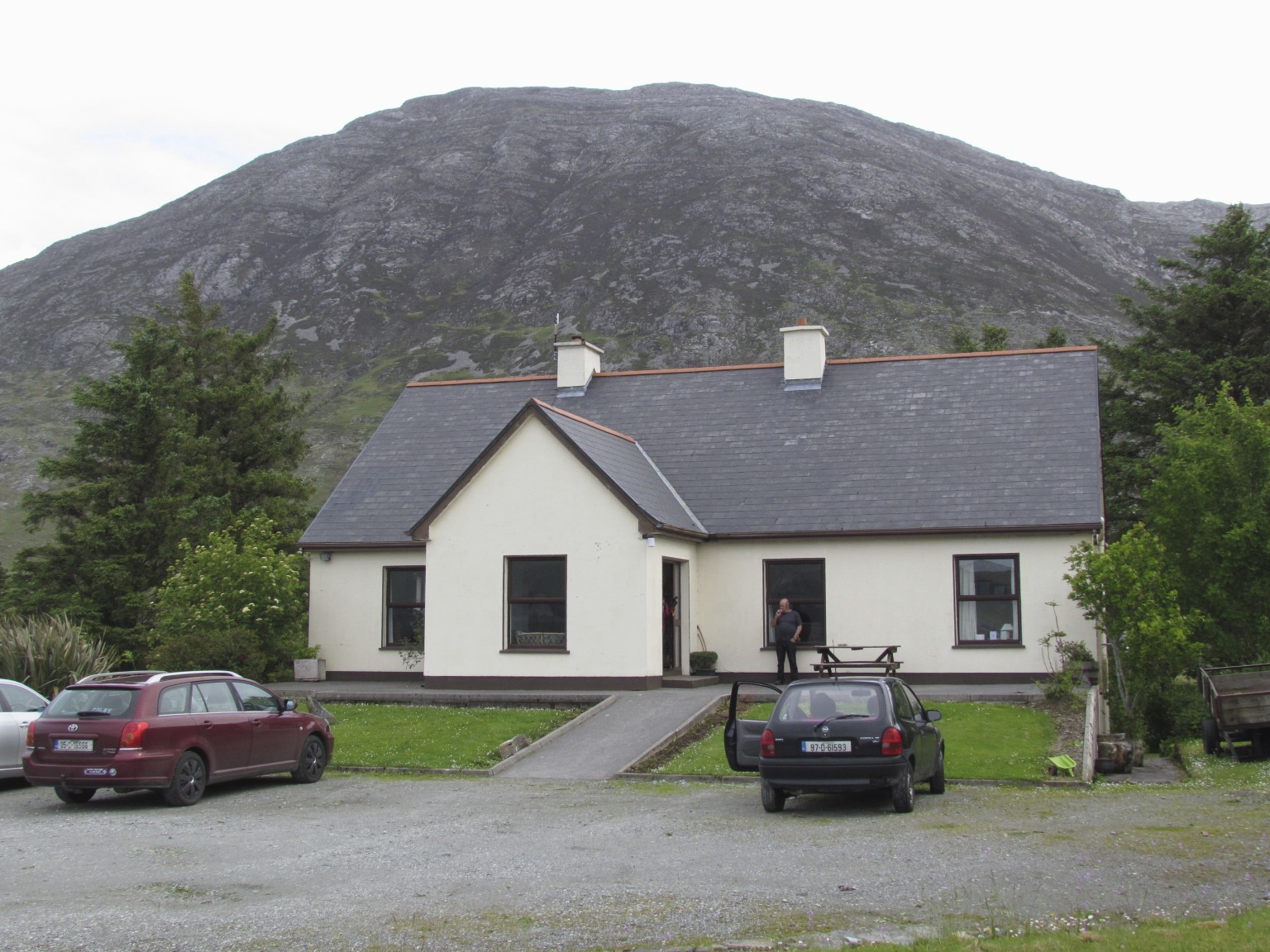
At the bottom of the track we reached another lonely road that took us, after 5 kilometres, to our B and B for the night, Lough Inagh Ranch.  We were made very welcome with a cup of tea and a biscuit.  As promised by Hillwalk they took our damp outer gear and dried it overnight and we stuffed our boots with paper.  Dinner that night was at the swanky Lough Inagh Lodge.  We were joined by a young German couple who had started out that morning in the region of the board walk on the Western Way where they had camped.  They decided that the B and B was a wise choice after being buffeted all day in the rain.  They fell on their feet in another way because our large backpack was going to be taken to our next B and B in Leenane the next day and the host agreed to take their two backpacks to the same village where they could collect them from the village pub.
Lough Inagh Ranch B and B